FishTrack provides saltwater anglers with everything they need to find fish. The FishTrack app offers free cloudfree sea surface temperature (SST) charts, global satellite imagery and marine weather forecasts – all in one layered tool.
With FishTrack you can:
- View the latest SST, chlorophyll and true color satellite imagery
- Overlay bathymetry, ocean currents and sea surface height
- Save waypoints to mark fishing spots and catches
- Create routes to plan a trip and view distances and headings
- View marine weather forecasts and tides/solunar tables
- Save fishing chart imagery for offline use
- View your current location both online and offline
Don't fish blind! FishTrack helps you plan a productive trip offshore. Burn less fuel and find fish faster.
We want to hear from you! Submit your questions or comments through our app to let us know what you think. If you'd like to speak directly with our customer service team, please e-mail us at: support@fishtrack.com.
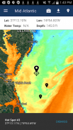
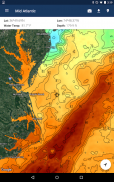
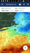
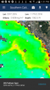
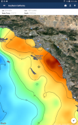
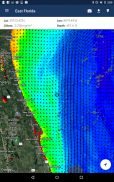
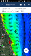
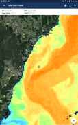
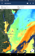
Fishtrack bietet Salzwasser Angler mit allem, was sie brauchen, Fisch zu finden. Die Fishtrack App bietet kostenlose wolkenMeeresoberflächenTemperatur (SST) Diagramme, die globale Satellitenbilder und Meereswettervorhersagen - alles in einem geschichteten Werkzeug.
Mit Fishtrack können Sie:
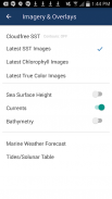
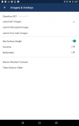
- Sehen Sie sich die neueste SST, Chlorophyll und farbechte Satellitenbilder
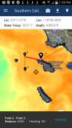
- Overlay bathymetry, Meeresströmungen und Meeresoberflächenhöhe
- Speichern von Wegpunkten Angelplätze und Fänge zu markieren
Erstellen Sie Routen eine Reise und Blick Entfernungen und Überschriften zu planen -
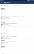
- Blick marine Wettervorhersagen und Gezeiten / Solunar Tabellen
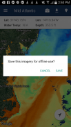
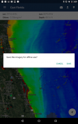
- Angelkarte Bilder für die Offline-Nutzung speichern
- Informieren Sie Ihren aktuellen Standort sowohl online als auch offline
Nicht Fisch blind! Fishtrack hilft Ihnen, eine produktive Reise planen offshore. Brennen weniger Kraftstoff und finden Fisch schneller.
Wir wollen von dir hören! Geben Sie Ihre Fragen oder Kommentare über unsere App zu lassen Sie uns wissen, was Sie denken. Wenn Sie direkt mit unserem Kundendienst-Team zu sprechen möchten, schreiben Sie eine E-Mail an: support@fishtrack.com.
FishTrack provides saltwater anglers with everything they need to find fish. The FishTrack app offers free cloudfree sea surface temperature (SST) charts, global satellite imagery and marine weather forecasts – all in one layered tool.
With FishTrack you can:
- View the latest SST, chlorophyll and true color satellite imagery
- Overlay bathymetry, ocean currents and sea surface height
- Save waypoints to mark fishing spots and catches
- Create routes to plan a trip and view distances and headings
- View marine weather forecasts and tides/solunar tables
- Save fishing chart imagery for offline use
- View your current location both online and offline
Don't fish blind! FishTrack helps you plan a productive trip offshore. Burn less fuel and find fish faster.
We want to hear from you! Submit your questions or comments through our app to let us know what you think. If you'd like to speak directly with our customer service team, please e-mail us at: support@fishtrack.com.